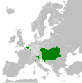
Fexeiro:Habsburg Hereditary Lands (1789).svg

Fexeiro oureginal (fexeiro SVG, de 450 × 456 píxeles, tamanho: 792 KB)
Este fexeiro ye de Wikimedia Commons i puode ser outelizado por outros porjetos. La çcriçon na páigina oureginal ye amostrada ambaixo.
Legendas
Elementos retratados neste ficheiro
retrata Portuguese
criador Portuguese
Um valor sem um elemento no repositório Wikidata
situação dos direitos autorais Portuguese
protegido por direitos autorais Portuguese
licença Portuguese
origem do arquivo Portuguese
data de criação ou fundação Portuguese
13 agosto 2013
tipo de média Portuguese
image/svg+xml
Stórico de l fexeiro
Clique an ua data/hora para ber l fexeiro tal cumo el staba naquel sfergante.
| Data i hora | Amostra | Tamanho | Outelizador | Comentairo | |
|---|---|---|---|---|---|
| atual | 08h20min de 17 de outubre de 2021 |  | 450 × 456 (792 KB) | Fenn-O-maniC | Fixed the Russo-Swedish border to match the Treaty of Åbo of 1743 |
| 00h26min de 13 de agosto de 2013 |  | 450 × 456 (796 KB) | TRAJAN 117 | {{Information |Description ={{en|1=The Habsburg Hereditary Lands in 1789.}} |Source ={{own}} {{AttribSVG|Blank map of Europe 1815.svg|Alphathon}} |Author =TRAJAN 117 {{created with Inkscape}} |Date =2013... |
Lhigaçones de l fexeiro
Esta páigina lhiga este fexeiro:
Outelizaçon global dun fexeiro
Las seguintes wikis outelizan este fexeiro:
- Outelizaçon na ar.wikipedia.org
- Outelizaçon na arz.wikipedia.org
- Outelizaçon na azb.wikipedia.org
- Outelizaçon na az.wikipedia.org
- Outelizaçon na bg.wikipedia.org
- Outelizaçon na bn.wikipedia.org
- Outelizaçon na bs.wikipedia.org
- Outelizaçon na cs.wikipedia.org
- Outelizaçon na cy.wikipedia.org
- Outelizaçon na de.wikipedia.org
- Outelizaçon na el.wikipedia.org
- Outelizaçon na en.wikipedia.org
- Outelizaçon na en.wikibooks.org
- Outelizaçon na eo.wikipedia.org
- Outelizaçon na eu.wikipedia.org
- Outelizaçon na fi.wikipedia.org
- Outelizaçon na ga.wikipedia.org
- Outelizaçon na he.wikipedia.org
- Outelizaçon na hu.wikipedia.org
- Outelizaçon na hy.wikipedia.org
- Outelizaçon na id.wikipedia.org
- Outelizaçon na ja.wikipedia.org
- Outelizaçon na ko.wikipedia.org
- Outelizaçon na mk.wikipedia.org
- Outelizaçon na ms.wikipedia.org
- Outelizaçon na pt.wikipedia.org
- Outelizaçon na ro.wikipedia.org
- Outelizaçon na rue.wikipedia.org
- Outelizaçon na ru.wikipedia.org
- Outelizaçon na sk.wikipedia.org
- Outelizaçon na sl.wikipedia.org
- Outelizaçon na th.wikipedia.org
- Outelizaçon na tr.wikipedia.org
- Outelizaçon na uk.wikipedia.org
- Outelizaçon na vi.wikipedia.org
- Outelizaçon na www.wikidata.org
- Outelizaçon na zh.wikipedia.org
Metadados
Este fexeiro ten mais anformaçon, l mais cierto ajuntada a partir de la máquina de retratos ó de l scanner outelizada para l criar.
Causo l fexeiro tenga sido demudado a partir de l sou stado oureginal, alguns detailhes poderán nun amostrar por cumpleto las altaraçones feitas.
| Título curto | A blank map of Europe ca. 1789 |
|---|---|
| Título | A blank map of Europe, circa 1789. This map is licensed under the Creative Commons Attribution-Share Alike 3.0 Unported license (https://creativecommons.org/licenses/by-sa/3.0/) by the wikimedia user "Alphathon" (http://commons.wikimedia.org/wiki/User:Alphathon), and is based upon "Blank map of Europe.svg" (http://commons.wikimedia.org/wiki/File:Blank_map_of_Europe.svg), the details of which follow:
A blank Map of Europe. Every country has an id which is its ISO-3166-1-ALPHA2 code in lower case. Members of the EU have a class="eu", countries in europe (which I found turkey to be but russia not) have a class="europe". Certain countries are further subdivided the United Kingdom has gb-gbn for Great Britain and gb-nir for Northern Ireland. Russia is divided into ru-kgd for the Kaliningrad Oblast and ru-main for the Main body of Russia. There is the additional grouping #xb for the "British Islands" (the UK with its Crown Dependencies - Jersey, Guernsey and the Isle of Man) Contributors. Original Image: (http://commons.wikimedia.org/wiki/Image:Europe_countries.svg) Júlio Reis (http://commons.wikimedia.org/wiki/User:Tintazul). Recolouring and tagging with country codes: Marian "maix" Sigler (http://commons.wikimedia.org/wiki/User:Maix) Improved geographical features: http://commons.wikimedia.org/wiki/User:W!B: Updated to reflect dissolution of Serbia & Montenegro: http://commons.wikimedia.org/wiki/User:Zirland Updated to include British Crown Dependencies as seperate entities and regroup them as "British Islands", with some simplifications to the XML and CSS: James Hardy (http://commons.wikimedia.org/wiki/User:MrWeeble) Validated (http://commons.wikimedia.org/wiki/User:CarolSpears) Changed the country code of Serbia to RS per http://en.wikipedia.org/wiki/Serbian_country_codes and the file http://www.iso.org/iso/iso3166_en_code_lists.txt (http://commons.wikimedia.org/wiki/User:TimothyBourke) Uploaded on behalf of User:Checkit, direct complaints to him plox: 'Moved countries out of the "outlines" group, removed "outlines" style class, remove separate style information for Russia' (http://commons.wikimedia.org/wiki/User:Collard) Updated various coastlines and boarders and added various islands not previously shown (details follow). Added Kosovo and Northern Cyprus as disputed territories. Moved major lakes to their own object and added more. List of updated boarders/coastlines: British Isles (+ added Isle of Wight, Skye, various smaller islands), the Netherlands, Germany, Czech Republic, Denmark, Sweden, Finland, Poland, Kaliningrad Oblast of the Russian Federation (and minor tweaks to Lithuania), Ukraine, Moldova (minor), Romania, Bulgaria, Turkey, Greece, F.Y.R. Macedonia, Serbia, Bosnia and Herzegovina, Montenegro, Albania, Croatia, Italy (mainland and Sicily), Malta (http://commons.wikimedia.org/wiki/User:Alphathon). Added Bornholm (http://commons.wikimedia.org/wiki/User:Heb) Released under CreativeCommons Attribution ShareAlike (http://creativecommons.org/licenses/by-sa/2.5/). |
| Largura | 450 |
| Altura | 456 |


